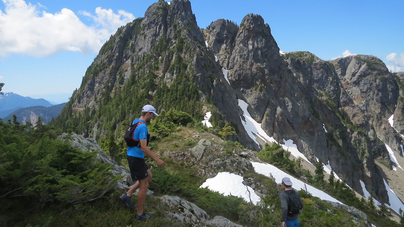
Skyline Ridge Trail
The Skyline Ridge Trail travels up the center ridge in the Upper Shannon Creek watershed. It is a direct line up to the alpine between Sky Pilot and Goat Ridge and encompasses some of the most beautiful terrain in the area. Skyline Ridge Trail offers views of Goat Ridge, the granite dome of Mount Habrich and the high alpine peaks around Sky Pilot Mountain. Due to the extended end of the marked trail finish, people should expect the last 10-15 trail tags to alternate between traditional trail tags and painted tags on rocks.
DIRECTIONS:
SUMMIT LODGE TO START OF TRAIL | 3.9 KM | 1 - 1.5 HOURS
- Follow the Backcountry Access Road to the Sky Pilot/Shannon Basin intersection
- Head right at the fork and then cross the Shannon Creek bridge
- From here, head straight until you reach the Skyline/Shannon Basin intersection
- Bear left for 100m onto the Skyline Ridge Trail before you get to an intersection and sign outlining the start of the Skyline Ridge Trail
SKYLINE RIDGE TRAIL | 10 KM | 4 - 6 HOURS
- Follow the purple trail tags
- This trail is an out and back trail
END OF TRAIL TO SUMMIT LODGE | 3.9 KM | 1 - 1.5 HOURS
- To return to the start of Harrys trail and the Shannon Creek bridge continue right as you descend from the start of the Skyline Ridge Trail onto Shannon Basin Loop.
This is a true alpine adventure, and we strongly recommend that you only venture into this terrain with a strong level of experience, a good knowledge of backcountry travel and the Sea to Sky Gondola app downloaded for navigation.
DOWNLOAD OUR TRAIL APP FOR YOUR NEXT HIKING ADVENTURE
The app will track your location on the map, regardless of whether you have a cell signal.

![]()